What: Superstition Ridgeline Hike
Where: Superstition Wilderness Arizona
When: Nov 24, 2012
Who: Justin & Leonard
Why: Have been looking up at this ridgeline daily for 10+ years...time to gettr done.
The Superstition ridgeline trail is one of the most scenic I have done in the Phoenix area. The sharp edge of it can be seen Mesa, Gold Canyon, Apache Junction...it has been calling to me for a long time. It is a little over 12 miles long, 5000 feet elevation gain over all, and requires some scrambling and route finding...although not much.
This is a through hike for Justin and I...and we convinced my
sweet wife to help us with the car shuttling. We would complete the route from East to West...Carney Springs trail head to Syphon Draw. Other guides say this route is very difficult and will require 8-12 hours of hiking...we were on the move for nearly 6 hours, but had 2 hours of breaks...pictures, food, etc...

Elevation Profile.

Route mapped and charted using the Garmin 305, then plugged into Strava.
Justin and I at Carney Springs trail head.
Looking up towards Superstition Peak...4 miles and 3000+ feet to the summit.
Mushroom Rock?
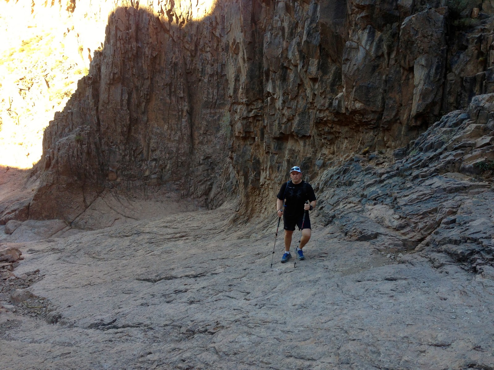
Carney Springs Canyon.
Hoodoo's can be seen throughout this hike...great views as you gain the ridgeline
Trail Marker
It had rained a few weeks earlier in the Supers...not sure if this is coming from the spring or was left over from the rain. Either way, didn't look to tasty.
Nearing the top of Superstition Peak.
More Hoodoos.
Looking down towards Gold Canyon.
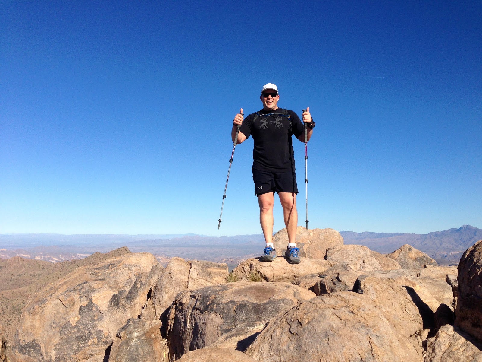
Superstition Peak Summit - 5057 feet - Highest point in the Superstition Wilderness.
Geological Survey
Registering at the Summit.
The view back towards Roosevelt Lake.
The summit requires a 15-20 minute detour from the ridgline trail. Back on it now, heading to Syphon draw...8 miles to go.
A little scrambling...nothing serious. Kind of had to spot Justin in this picture...really blends in.
Looking west towards Mesa...Ridgeline Trail follows the highest points...all the way to Flat Iron.
Looking down Hieroglyphic Canyon.
Great views of Weavers needle throughout the hike...been there, camped on the summit :)
Looking down towards Gold Canyon.
We were told that an 80 year old hiker had died on the trail a year ago.
Looking down the ridgeline.
Panoramic.
As you can see...this is not a well maintained trail...although fairly easy to follow.
Gap leading to Flat Iron.
Hoodoo's near Flat Iron
Heading down Syphon Draw...first time I have really had pain in my knees :) ... was a bit of a trek finishing this hike off.
The only 200 feet of hiking up...to get down the 3000 foot decent to Lost Dutchman Park.
Syphon Draw...almost done.
Looking back to the Flat Iron, and Syphon Draw.
Another "Chicken Ledge." Justin was too scared to climb to the top of the point...I had nothing to prove so I didn't either :)
Summary: This hike has replaced Syphon Draw as my favorite in the valley. It is long and the trail can be rough in spots, but the views are incredible. Was good to get out and push myself in the mountains and spend time with a good friend. Definitely recommend this one and will do it again! Whats Next?


hi, can you clarify, 6 miles total? like 4 hours hiking 2 for breaks. or 8 hours total, 6 of hiking and 2 of breaks. thinking about going this weekend, thanks!
ReplyDeleteHi Randal - this hike was actually 12 miles...but can be 13-14 depending upon where you park. Took us 6 hours hiking and 2 hours break. No water up there. Have a great hike!
ReplyDeleteVery nice. Would have like to see a photo of the actual ridgeline. I believe your photo is more from the north. Good job! This is on my bucket list too.
ReplyDeleteNice set of pictures!
ReplyDeleteI've got a ridgeline photo from afar here.
https://hikearizona.com/photoset.php?ID=39151