Where: Beartooth Absaroka Mountains Montana
When: Aug 25-27, 2011
Who: John and Leonard Zito (Brothers)
Why: John and I backpacked to Avalanche lake and the climbers high camp 5+ years ago...always talked about coming back to climb Granite Peak...so we did.
Granite Peak is the state High Point for Montana...12,899 Feet, successfully summited by approximately 10-20% of climbers annually (reported by Forest Service.) There are several factors that contribute to the low success rate of this adventure...we experienced all of them: 24 miles round trip with 7-8000 feet elevation gain, misquitos/bugs, crazy weather (rain/hail,) and significant exposure while climbing. DO NOT UNDERESTIMATE this mountain! Reports of "Granite Peak in a Day" can be mis-leading...people doing this are hard-core and are not typically brining safety gear...and know the route very well.

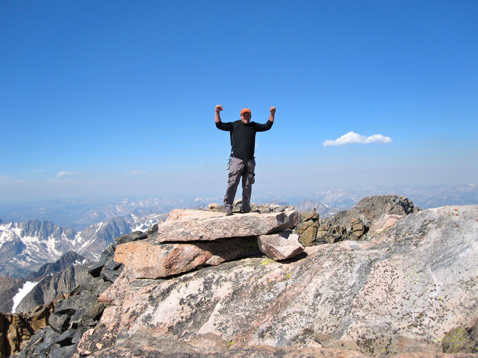
Granite Peak early morning Summit Day.

Elevation Profile from West Rosebud Trailhead to Tempest Mountain upper climbers camp.

----------------------------------------------------------------------------------------------------------------------------------
Getting There...with Google Earth

Did my best with Google Earth to show the route. Gives a good approximation of the hike if you follow the red/grey route from West Rosebud trailhead to the upper climbers camp.
West Rosebud Trail head (6,400") to Mystic Lake (7,637"): 3 miles & 1,200" elevation gain.

Mystic Lake (7,637") to Froze to Death Plateau (10,000"): 2.5 miles & 2,500" elevation gain. Known as the "switchbacks from hell"... you definitely earn that elevation gain but trail is in great shape and much better than Mystic Lake to Avalanche!

Froze to Death Plateau (10,000") to Upper Climbers Camp (12,000") 5 miles & 2,000" elevation gain. Lots of bolder fields, swampy/grassy areas with some snow fields.
Upper Climbers Camp (12,000") to Granite Peak Summit (12,899") ... approximately 1000" descent down Tempest before starting up Granite. About 1.5 miles from upper camp to summit.
----------------------------------------------------------------------------------------------------------------------------------
Day 1: Was able to catch an Allegiant Air flight from Mesa AZ to Billings. John picked me up at the airport 7:30pm and after a short gas station stop we were gearing up at West Rosebud by 9:30pm. We planned to hike into Mystic Lake in the dark...can't get enough of the Beartooths and would be nice to take a little off the top of a difficult Hike for Day 2.
Gear List - Approximately 35lbs per person...including 100oz of H2O per person.
- 2 person tent, MSR water filter, 1lb of Teriyaki Meat Balls (and misc other food.)
- 60m climbing rope (necessary for double rappels...would not go shorter), 4 Omega Pacific Link Cams, 6-8 pieces of webbing, Harnesses etc..
- Rain coats, few extra socks, and misc gear


Video of hike to Mystic Lake...from truck to campsite in about an hour and a half.
-------------------------------------------------------------------------------------------------------------------------------
Day 2. Mystic to Tempest Upper Climbing camp
Mystic Lake Morning...Breakfast burrito's, filter water for the camel backs and off to the switchbacks.


26+ switch backs...2,500" ... good times and great views.


Topped out after the switch backs...approximately 10,000. Air is getting thinner...cool rock cairn with Horse Skull to begin the path across Froze to Death to Tempest Climbers camp.


Crossing some snow. Wishing these trail runners were gortex!

Froze to Death local residents. We sat down watching them while having lunch. They came right over to us...made for some great pics and videos.
Great shot of the goats...you would have to have been on a few other adventures with the Zito brothers...but John has a strange uncontrollable urge to chase wild life...including moose, geese, deer, and now mountain goats.

Hail storm on Froze to Death...from Dark clouds to full on storm in about 30 seconds! No cover...just had to put our packs over our head and tough it out. Glad it didn't last more than 10 minutes...some were the size of quarters. Bruises are mostly gone now...a week later.

Made it to the upper climbers camp on Tempest. John and I built this rock cairn 5 years ago...well, we made it about 10 times bigger and added the quartz to the top.


John got the tent setup up and dinner started while I filled our camel backs and prepped for tomorrow.


---------------------------------------------------------------------------------------------------------------------------------
Day 3. Climbers camp + Granite Peak Summit + back to West Rosebud Trail head + drive back to Billings = very long day! Began at 6:30am...back to Billings at 2:30am.

Climbers trail well marked down to saddle/bivy joining Mt Tempest and Granite Peak.


Actually taken on the way down...gives a good picture of the ridgeline heading up to the snow bridge. Route/cairns follow closer to the right edge.


One of many Class 4 scrambles. Roping up on these pitches would take too much time...be prepared to take 10+ hours for summit day. (yes...we were slow and cautious.)

John coming up one of the several "easy" pitches. The exposure could mess with your head...but focus on what you were doing and not looking down alot :) made it much easier.


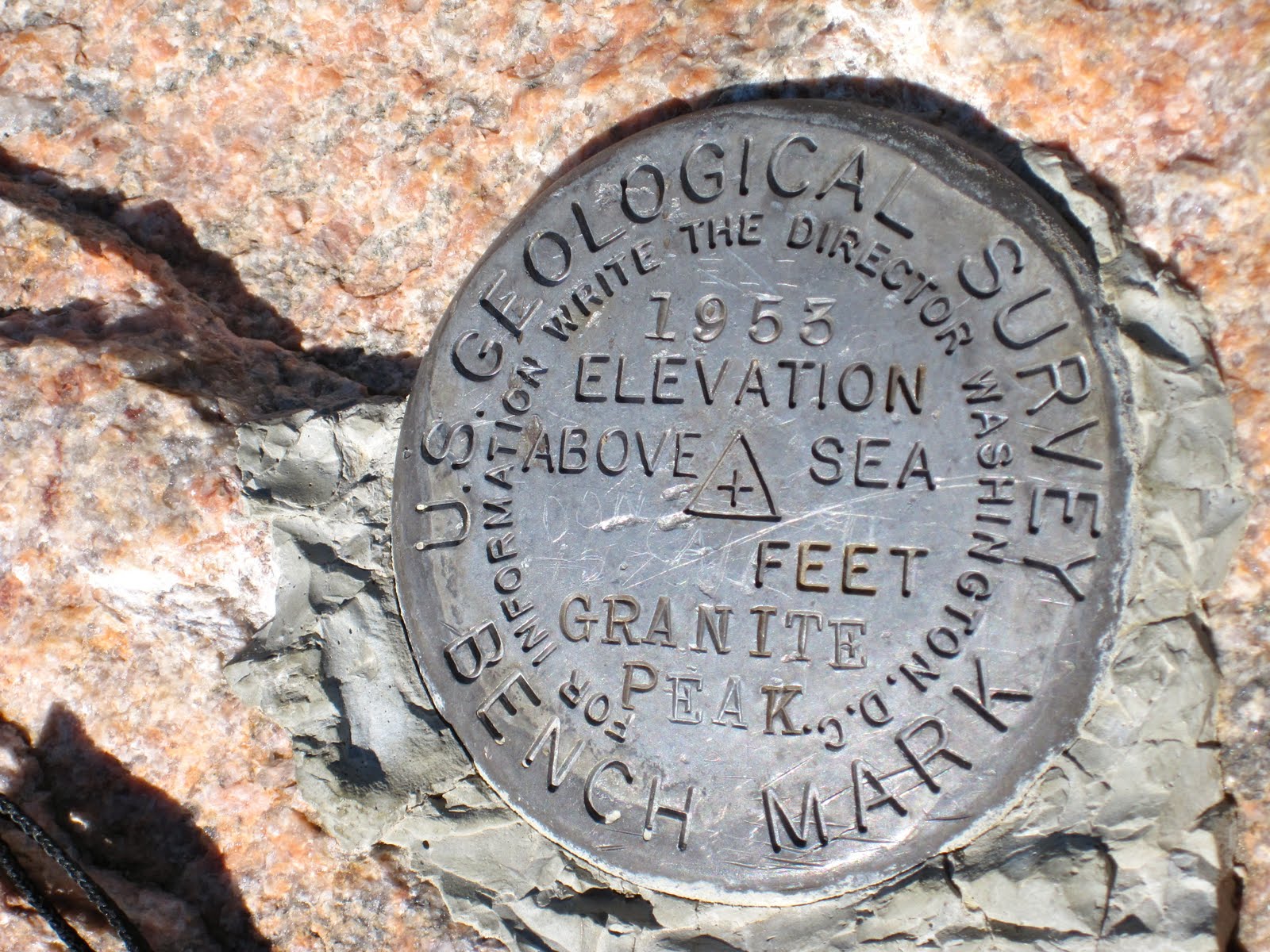
Geological Survey at the summit.

Definitely worth the trip. Amazing day, incredible views, and great times with my Brother!

Snow Bridge and Summit Video


Heading back down.


We rapp'd 6-7 times on the way back down...to speed things up and "down climb" as little as possible.


We were limping back into the truck by midnight...and back to Billings by 2:30am. Up at 8am and at church by 9am :)
Summary: We had a great time...both pushing out endurance and nerve...if you don't do this type of thing frequently I think it can be a serious challenge. The climb was more exposed and route finding more difficult than I had anticipated. If you have not done this route before, I would highly recommend finding a partner who has. Plan for bad weather, know basic trad climbing/mountaineering, anticipate things to taking longer than you think!

Had a great time Brother! What's next?