Where: Usery Mountain Regional Park (Mesa Arizona)
When: Dec 20, 2010
Who: Solo Hike
Why: Tired of the treadmill desk...needed to get out in the fresh air!
Draw backs of the Treadmill Desk (hit 55 miles this week so far) ... could not stand one more minute walking and working today...had to get out and breathe some fresh air. I have been planning to take a group of friends this weekend to explore/route the Usery Mountain Ridge Line. I figured there must be a trail across it but couldn't find anything in guidebooks or internet...but the more I thought about it...the more I worried that I would be getting my pals in over their head...so I decided to speed hike it solo :) Was definitely an adventure...can't believe it is so close to my back yard! Some good elevation gain, narrow ridge line portions, route finding, scrambling, and a little off trail fun!
Route Description: I followed the Wind Cave Trail, past the cave to the ridgeline...summited and then headed North. There is a faint trail that can be hard to follow. Exit down to Pass Mountain Trail was a little tricky and I did get off trail. Looking back on it, I see where I went wrong...will get another chance this weekend.
Distance: 5.8 miles
Time: 2 hours 44 minutes
Elevation: 1,594 Feet gain
Usery Mountain Ridge Line...Wind Cave at the far right end of the yellow band.

Elevation Profile

Yeah...I pushed it pretty hard to finish the route in 2.5 hours...would have liked to slow it down and take more pictures.
Courtesy of the new Garmin Fenix! Sold my old iPhone and used a gift card...great replacement!
Google Earth Image...Ridge Line Route.
Was unable to find the path down this small cliff band...ended up circling back and side hilling it...probably cost me 20-30 minutes.

Hiking up the Wind Cave trail. Maintained about 3mph entire way...no stopping until topping out on the ridge line.
At the summit of the Wind Cave Trail (several hundred yards up from the Wind Cave.)

Panorama shot from the iPhone...same location.
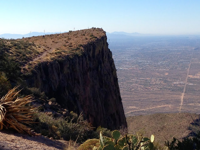
Looking back towards Mesa.
Looking North along the Ridge Line. Route stays fairly close to the West Edge the entire way.
Highest Point on the Ridge. Geo Cache and Summit Register Ammo can...view looking down towards Pass Mountain Trail.

Panorama from highest point along the route.
Looking south...back along the ridge line.
Usery Shooting Range and Red Mountain can be seen looking West.
Ridgline looking North. 4 peaks in the distance.
The last part of the ridge line...descent was a little difficult to follow and I did get off trail...see Google Earth images above.


